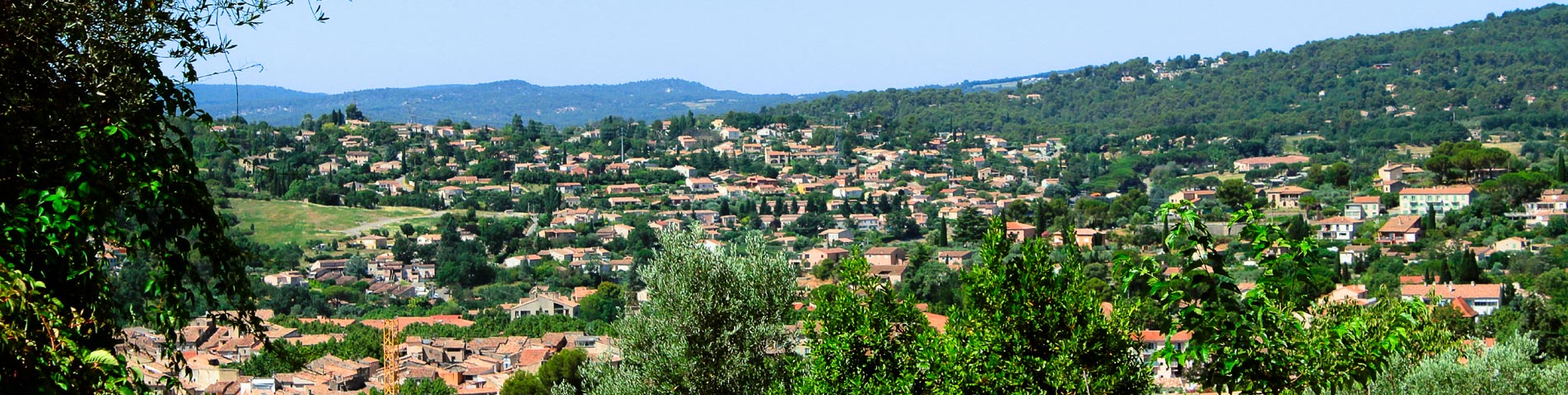
Tourism in Provence
Provence is an authentic region that offers many leisure and sports activities, as well as first class tourist sites to organize your stay.
Aren’t vacations also about discovering new things and unusual places?
In this section we have listed the activities and visits in the Haut Var, along with what we consider to be the main points of interest in the vicinity of Camping Ginasservis.
Enjoy yourself and discover with us the Provence, the Haut Var and the Verdon !
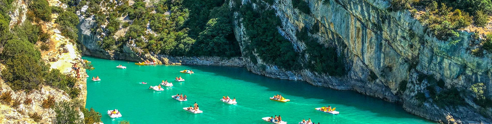
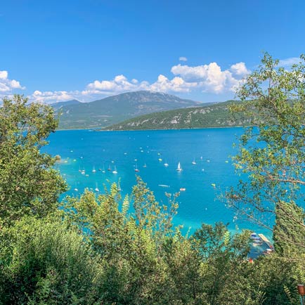
Visit the Gorges du Verdon
A tumultuous throat
The Verdon gorges are a natural border between the Var and the Alpes-de-Haute-Provence. This spectacular fault is one of the major sites in Europe.
This gigantic notch of 250 to 700 meters deep is the result of the fantastic work of erosion of the Verdon in the Jurassic limestones of the plans of Provence.
Until the beginning of the 20th century, the deepest of these gorges were considered to be inaccessible.
In 1905, following a need to increase drinking water resources, the Minister of Agriculture became interested in the Verdon and ordered a study which led to the recognition of the gorges.
Discovering the Verdon à la carte
- The Verdon Natural Park : Created in 1997, it extends over 45 municipalities and 180 000 ha on the borders of Provence and the Alps. It includes the gorges, as well as 5 artificial lakes (Esparron-de-Verdon, Sainte-Croix, Quinson, Castillon and Chaudanne). We discover superb panoramas there as well as 5 villages of sentinels nestled on the edges of the fault.
- The road of the peaks: This is the most beautiful and wildest road, it offers fantastic escarpments and beautiful viewpoints.
- Hiking trails: There are ten hiking trails from 2 to 8 hours. The best known are the Imbut trail on the left bank and the Martel trail on the right bank.
- Along the water: Only experienced kayakers should venture out. The length, the duration, the difficulty of the course as well as the absence of an emergency exit are the reasons for this. In addition, the water level can vary abruptly depending on upstream dams.
The pre gorges and Rougon
The “Grand Canyon” begins at the confluence of the Baou and runs for 21 kilometers to the Galetas, at the outlet of the lake of Sainte-Croix.
In these faults, the Verdon descends 153 meters with an average slope of 8 meters and a speed that never goes below 2 meters per second.
Once arrived in Rougon, it is possible either to go up to the village which has an impregnable view on the Verdon, or to go towards the Sublime point and gain the bottom of the gorges by foot by the Samson corridor.
La Palud-Sur-Verdon
The site of La Palud has revealed a very ancient human occupation. Traces of Gallo-Roman habitat have been found there. Christianization was accompanied by the installation of monks, probably in the caves of Saint-Maurin as the existence of a rock chapel seems to indicate.
The castle dates from the 15th century and was extended in 1744. It is a massive building with a Roman tile roof with 4 slopes. It dominates the houses by its quadrangular mass flanked by turrets.
It is from La Palud-sur-Verdon that we reach the route des Crêtes. Belvederes mark out this itinerary, and allow to appreciate vertiginous points of view.
La Barre de l’Escalès, La Carelle, Le Trescaire, and La Dent d’Aire are lookouts that have become climbing sites.
Since the construction of the dam, the exit on the gorges of Verdon offers a fairy-like spectacle where all the possible shades between emerald and turquoise mark the passage of the waters of the torrent in the lake Sainte-Croix.
Moustiers-Sainte-Marie
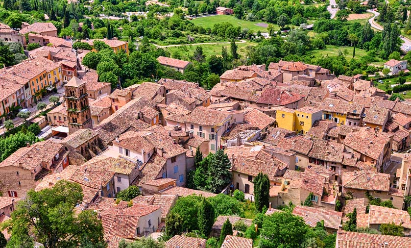
The village of Moustiers is built in an amphitheater at the entrance of a crevice opened in the cliff, from which a torrent escapes and flows down in the middle of the village in successive waterfalls.
The center of the village offers a beautiful architectural ensemble with its narrow streets, its houses made of limestone rubble, and its light-colored tile roofs… A steep path, marked by the stations of the cross, leads to the narrow ledge where, between the two high rock walls, stands the chapel of Notre-Dame de Beauvoir.
Moustiers became an important place of pilgrimage since some miracles, recognized by the papal authority, occurred there in the 9th century. The source of income generated by the pilgrimages explains the extent of the constructions that the religious made from the 12th to the 15th century.
A long tradition of pottery was established here thanks to the abundance of raw materials, but it is not known how this small village began to produce earthenware and succeeded in becoming one of the largest earthenware centers in France.
The museum of earthenware is installed since 1996 in the town hall.
Vinon-sur-Verdon
Vinon-sur-Verdon is a small town in the Var, at the crossroads of the Bouches du Rhône, Alpes-de-Haute-Provence and Vaucluse departments. Vinon flourishes on the banks of the Verdon and invites visitors to discover its beautiful 17th and 18th century houses.
Activities proposed on the Verdon and in the surroundings:
- Gliding, horseback riding, microlighting, canoeing, tennis and climbing.
- 250 rare domestic animals at the Animal Park.
Visiting the local markets is an indispensable and appreciated step during the vacations.
It allows to buy local products and to discover the local culture of the Provence region.
- Market of Vinon : Sunday
- Market of Rians : Saturday
- Market of St-Maximin : Wednesday
- Market of Gréoux les Bains : Thursday and Tuesday
- Forcalquier market : Monday
- Market of Riez : Wednesday and Saturday
- Market of Manosque : Saturday
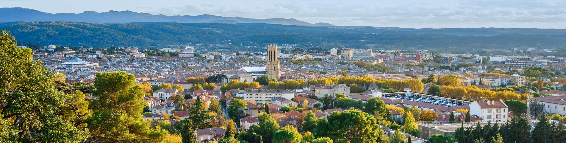
Discovery of the city of Aix-en-Provence
Aix-en-Provence is located 30 kilometers north of Marseille
Situé à 15 kilomètres à l’ouest de la montagne Sainte-Victoire et à 30 kilomètres au nord de Marseille dans un bassin formé par les rivières Arc et Torse.
Since the last Insee census update (figures collected in 2006, official 2008), Aix en Provence has become the largest French suburban city in terms of population, ahead of Villeurbanne in the Rhône (69).
However, some believe that it is more appropriate to speak of a two-headed agglomeration (two central cities within the same agglomeration).
Religious buildings of Aix-en-Provence
The city of Aix-en-Provence aims to obtain the City of Art and History label. It previously held the City of Art label.
Aix-en-Provence has two stars in the Michelin Green Guide. You will be able to visit :
- Saint-Jean-de-Malte church : The Saint-Jean-de-Malte church, not far from the Cours Mirabeau, is the first Gothic church in Provence.
- Cathedral of Saint-Sauveur: Triptych of the Burning Bush (altarpiece of King René) by Nicolas Froment; altarpiece of the Legend of Saint Mitre (15th c.); tapestries : Life of the Virgin and Jesus (end of the 15th c.).
- Cloister Saint-Sauveur : end of XIIth century. the formed roof is supported by arcades. The paired columns, the capitals with foliage or historiated give a lot of elegance to the construction.
- Notre-Dame de la Seds Church: The current building dates from 1853 and is the work of the Aix architect Henri Antoine Révoil. This church is built in a Romanesque-Byzantine style.
- Church of the Holy Spirit: This church was built from 1706 to 1728 by the Vallon brothers. The sculptures and decorations were made between 1726 and 1728. Mirabeau’s wedding was celebrated in this church.
Museums, foundations and libraries
Aix en Provence is also a culturally rich city where you can visit exceptional places:
- Museum of Tapestries: Collection of the former archbishopric. Tapestries executed in Beauvais in the 17th and 18th centuries, some after Bérain and a series of 9 panels of the life of Don Quixote, 4 other panels executed after Leprince.
- Musée Granet : Built in 1671, the priory was transformed into a museum in 1838. François Marius Granet bequeathed an important collection of paintings and the establishment took the name of its donor in 1949.
- Musée du Vieil-Aix : Opened in 1933 in the Hôtel d’Estienne-de-Saint-Jean : collections of costumes, earthenware, puppets, reconstructing life in Aix under the Ancien Régime and in the 19th century.
- Vasarely Foundation: Built in 1973 on the plans of the artist Victor Vasarely. Its facade, a succession of huge black or white circles, is characteristic of his work.
- Cité du Livre: Built on a vast rehabilitated industrial wasteland, it brings together the Méjanes municipal library and its institutional, associative and educational partners.
- Natural History Museum of Aix-en-Provence
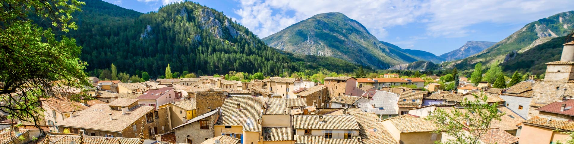
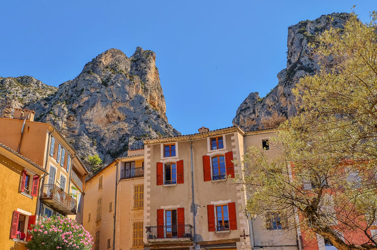
History of Castellane
This city is one of the two doors of the Gorges du Verdon
Hikers and tourists will find it a pleasant stopover.
The city of Castellane is nestled below a strange rock and offers its Mediterranean colors and gentle strolls in its picturesque streets.
The city was apparently occupied by a Ligurian tribe that had built an oppidum there. Later, the Romans, lovers of its salty springs, settled there.
In the Middle Ages, the Saracens devastated the region and the town forcing the inhabitants to take refuge on the steep ridge allowing them a close watch. Some remains of the city can still be seen today, such as the church of Saint-André-du-Roc.
The birth of the lower city is explained by the lack of water and the place too narrow. The population began to descend from the Roc in the 11th century and developed a new district, the village, in the 12th and 13th centuries.
It became so important that it was decided to build a church, Saint-Victor. A dike and ramparts were built around the lower town to counter the troubles of the Hundred Years War, as well as the floods of the Verdon.
The ramparts of Castellane
There are still beautiful remains of the ramparts built in 1359. The most remarkable elements are the pentagonal tower to the north and the city gates: the gate of the clock tower and the gate of the annonciade.
Forcalquier, its cathedral and its citadel
Discover Forcalquier and its surroundings, a city full of history
The mountains of Lure and Luberon, the Durance and the Cavalon have crossed their ridges and their bed to draw the basin of Folcalquier, where the human presence would go back to 100 000 years.
The site has the advantage of having a source. It was therefore named Font Calquier, which means spring of the rock.
History of Forcalquier
A rebel city
Located at the edge of the ancient Roman road, at the meeting point of the high and low countries, and a key place for their commercial exchanges, Forcalquier attracted in the XIth century a branch of the count family of Provence which settled there by taking the title of counts of Forcalquier.
The site was coveted by the two great regional powers of the time, the houses of Toulouse and Barcelona. The Counts of Forcalquier were very clever at political maneuvering and played on this rivalry, as well as on the more distant ambitions of the Germanic emperor, to maintain their own autonomy for a century and a half.
The problem of the bishopric
Forcalquier was also the residence of the bishop who, installed in Sisteron, had to flee the city, a city whose lords had seized all the ecclesiastical goods.
Canon law forbade him to transfer the seat of the bishopric to Forcalquier, so the bishop had an original idea: he pronounced the division of the prerogatives and the episcopal goods between the churches of Sisteron and Forcalqier, and gave almost all of his possessions to the latter city.
The end of the counts and modern times
In the 13th century, marriages associated the county with the counties of Provence and Anjou. This last dynasty reigned there until 1480. Louis XI inherited it and subdued Forcalquier by means of bombards, operated from a hill named since the Bombardière.
The city always rebel, participated in all the great moments of the national history In 1789, it was the place of election of deputies to the States General of Sisteron, Forcalquier and Barcelonnette. In 1851, the city and the country were leaders of the Republican revolt, and during the last war, it was one of the most active poles in the Resistance and obtained the war cross.
Around the cathedral
The Notre-Dame-Du-Marché Cathedral
Formerly called Notre-Dame-Du-Bourguet, the cathedral is the major monument of the city. In the 11th century, there were two churches there, Notre Dame and the Holy Sepulchre. The cathedral of Forcalquier is a monument to visit which testifies to the preeminence of the Catholic faith in the Pays d’Oc.
The market
It has existed since antiquity. This market is one of the most important of Provence and gathers every Monday morning, in the whole city, about 300 traders in winter, and 400 in summer.
The convent of the Visitandines
In front of the cathedral, a baroque church recalls the existence of a convent built for the visitandines in 1630 by the municipality. L’église devint salle de réunion lors de la Révolution, puis théâtre, salle de bal, cinéma. Les bâtiments conventuels accueillirent un collège de 1800 à 1903. Le musée municipal est abrité au dernier étage de cet édifice.
The Cordeliers convent
Witness to the importance of the Franciscan movement in Provence, this convent is, like the cathedral, the fruit of a skilful synthesis between the Romanesque and the Gothic which was imposed at the very moment when the Franciscans were charged by the papacy with the Inquisition in the counties of Provence and Forcalquier. However, Provençal Franciscanism was sometimes itself on the verge of heresy.
The Good Fountain
This spring feeds a set of fountains and wash houses dating from the end of the 15th century. Above the three lions’ heads from which the water gushes, a lover of first truths engraved in 1567: Iterum sities (you will still be thirsty).
Around the Citadel
Saint-Mari Street
At the end of Saint-Mari street lie the buried ruins of a round tower, the only remains of the 14 towers of the Citadel, razed in 1601, which once dominated the city. Only a few sections of the wall of the great Romanesque church of Saint Mari remain, which took its name when it welcomed, in 925, the relics of Saint Mari, threatened by the Barbarians. At the end of this street, it is still possible to see a part of the keep built by the bishop at the chevet of the church, which was integrated into the ramparts.
The church of Notre-Dame-De-Provence
It crowns the hill of Forcalquier, and was intended to be the national sanctuary of Provence. At the time of its inauguration in 1875, musical and literary prizes were awarded there.
The carillon
At the top of the citadel stands a carillon built in 1925, on the occasion of the celebrations of the millennium of the arrival of the relics of Saint Mari. The carillon is on the same level at the top of the hill, which allows the public to see the carilloneur in action. Around this carillon, the visitor can discover a panorama which extends from the Luberon to the Alps.
Towards the convent of the Récollets
The convent of the Récollets
It included the church of Saint-Pierre. In 1627, the chapter of Forcalquier ceded the church and the cloister house of Saint-Pierre to the Recollect monks, the name of the reformed Franciscans. 3 years later, the plague having put to flight almost all the secular clergy, but not the regulars.
The Recollects, who had distinguished themselves by their devotion, became very popular. The donations they received allowed them to enlarge the convent, which became the imposing building it is today. After the departure of the monks, it was transformed into a prison and, in 1851, housed the local allies of Louis-Napoleon Bonaparte, who had been imprisoned by the Forcalquierans, who were good Republicans.
The temple
The ideas of the Reformation gained a part of the Provençal people, with the Waldensians in 1489 and the Lutherans in 1538. After the edict of Saint-Germain, in 1576, Forcalquier was the only town in Provence, along with Mérindol, where the reformed cult remained authorized. On the pediment of the building is engraved this injunction (book of Isaiah): “Confess the Lord and call upon his name”.
The palace
Although the facade dates from 1842, justice has been administered here for 800 years and it is here that in 1206, Guilhem II freed the inhabitants from all lordly dependence, invoking the divine wrath on anyone who would violate their freedom.
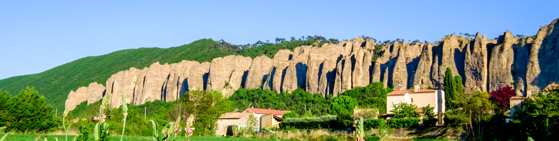
Les Mées and Pontis
History of stones
The rocks of Mées are a mixture of pebbles, sand and sandstone formed 25 million years ago. This rock resulted from the dissolution of limestone blocks torn off by the ancient rivers from the nearest massifs. The pudding zone of Les Mées, harder than elsewhere, has better resisted both erosion and the Durance which, on the western flank, has carved a vertical wall.
The rocks were sculpted by the gelification due to the alternation of the glacial periods and of diluvian rains.
Hiking
A path of crest makes it possible to make the turn of the Mées and to discover the secrets of their alchemy. It is recommended to start from the Saint-Roch chapel.
The village of Les Mées
The village, quite charming, has preserved some vestiges of its old ramparts, beautiful doors, and some interesting facades of the XVI° century. Les Mées was a particularly independent village, because, until Queen Jeanne made it subject to Guillaume Roger de Beaufort in 1350, the inhabitants were administered by elected syndics. They never stopped trying to regain their freedom and eventually bought back all their rights from the Beauforts.
The main enemy of this village was always the torrent of the Combe which regularly devastated the village. This caused a titanic construction site to build a tunnel through the rocks, and a dam to divert the water out of the city.
The village of Pontis
Pontis has a Valley Museum, where a classroom from the 1920s is reconstructed as a tribute to the valley that provided the Republic with a large number of teachers.
The church of the village presents on the vault a beautiful decoration of marble and gypseries of XVIII° century.
The Pontis pass is followed by a vertiginous descent along the adret, in a landscape of Scots pine, sea buckthorn and aromatic labia.
After the hamlet of Adroit-de-pontis, several paths lead to the Dolmen du Villard. This tomb, used in the Chalcolithic and Bronze Age, contains about forty skeletons, among bone ornaments, flint tools, fragments of vases, an archer’s armband, and a bronze dagger.
Manosque, the Saint-Sauveur church and its surroundings
The name Manosque is of Celto-Ligurian origin and means “inhabitants of the hills”.
After the sacking of the city by the Saracens around the year 900, Manosque was reborn around the church of Notre-Dame-de-Romigier from the 11th century.
Around the Saint-Sauveur church
Saunerie Door
Its name comes from the word saou, which means salt. Salt warehouses were installed at this place as early as the Middle Ages. This gate was built in 1382.
The main street
It is the commercial street of the city. You can see, between the shop windows, the beautiful walnut doors of the bourgeois houses. To discover the old Manosque, it is necessary to borrow the small lanes.
Saint-Sauveur Church
This unique parish of Manosque is typical of the Romanesque style of Provence. It contains rich furniture, carved wooden seats and paintings from the 17th and 18th centuries.
Voland House
It is a very beautiful bourgeois house located at number 5 of the street Voland. This building is historic in two ways for Manosque.
In 1367, the papal studium was established there. It looked like a large community of students and teachers. They left the house when a mysterious epidemic broke out in the school. It was a disease that drove people mad and then killed them.
The second historical fact concerns the arrival of François I° in Manosque. To honor the king, the consuls of the city presented him with the keys to the gates on a cushion, carried by the young and pretty Miss Voland. The looks of the monarch towards the young girl left her no doubt about the king’s intentions. Deeply disturbed, but not wanting to be compromised, nor to have to disobey the monarch, she would have disfigured herself with sulfur fumes to discourage the royal advances. When he learned of this act, Francis I, very touched by the virtue of the young woman, baptized the whole city with the nickname “Pudique”.
Around Notre-Dame-De-Romigier
City Hall
It has a beautiful two-story facade in classical style. It is one of the buildings to visit in Manosque.
Notre-Dame-De-Romigier Church
It is the oldest religious monument of the city. It shelters a very beautiful Virgin and Child of the XII° century venerated by the population, as well as furniture and superb stained glasses. Thanks to the numerous openings in the walls, this church is exceptionally bright.
Hotel d’Herbes
This hotel has long housed the municipal archives of Manosque. Since 2006, it has housed the city’s media library.
Soubeyran Gate
Its name means “superior” because it is, geographically speaking, the highest in the city. The base of the gate dates from the 14th century, while the stone ramp, the tower and the bell tower date from the 19th century. The latter is the work of a craftsman from Apt, Baucham, and its shape symbolizes the layout of the old town which is similar to that of a pear.
Guilhempierre Gate
It was named after the notary who wrote the privileges of the city, and was pulled down in 1836 on the petition of the inhabitants so that the air and the sun would purify the western district, ravaged by a cholera epidemic. A false door in Siporex was made in 1986 on the occasion of the first medieval festival.
Aubette Gate
The door of the little dawn was destroyed in 1934 to allow the entrance to the trucks in the city center.
Outside the walls
Carzou Foundation
The chapel of the former convent of the Presentation of Notre-Dame of the Carzou Foundation. The foundation offers visitors more than 666 m² of paintings by Jean Carzou between 1985 and 1991. Jean Carzou is an Armenian painter born in Aleppo, Syria in 1907.
Jean-Giono Center
Jean-Giono was born in 1895. He was a lyrical and visionary poet, a teacher of hope, a creator of myths and dazzling images, a subtle novelist and a joyful pessimist. He took a lucid and ironic look at humanity, cultivating his happiness in the humility of everyday life.
The center is located at the entrance of the city, in an old Provencal house.
Lou Parais
Jean-Giono lived in his house Lou Paraïs in Manosque from 1929 to 1970, when he died. Its garden dominates the city. The visitor can discover the office and the library, one wall of which is painted in fresco by Lucien Jacques, a friend of the writer.
Mont d’Or
To discover Manosque, go up this hill. The ruins of a tower of the ancient castle of the Counts of Provence stand isolated in the middle of an olive grove. The belt of boulevards follows the line of the ramparts. At the foot of the Valensole plateau, you can see the Durance, a river that was capricious for a long time and is now disciplined.
Chapel of Toutes-Aures
The chapel of Toutes-Aures (of all winds) is located on a plateau suitable for walking, facing the hill of Mont d’Or. The Manosquins go up to the chapel in pilgrimage on Easter Monday and organize a big picnic there. It also celebrates the feast of the patron saint of the city, Saint Pancras.
Riez
Riez is the oldest city in the Alpes de Hautes Provence
Located at the confluence of two torrential streams, Riez is proud to be the oldest city of the Alpes de Hautes Provence.
You will discover its Gallo-Roman vestiges. Indeed, Riez, erected as a Roman colony, had acquired a real importance at the end of the Empire. Do not hesitate to go and see the Roman colonnade in grey granite which is the rest of the facade of a tetrastyle temple apparently dedicated to Apollo.
But the visit does not stop there!
You can also visit a Paleochristian baptistery, a worthy and rare witness of the Merovingian era in Provence. The exterior, catered for in the 19th century, is of little interest but the interior pool surrounded by a colonnade and an ambulatory is intact. The baptistery houses a lapidary museum.
The city
Surrounded by thick walls since its devastation in 1366, the city retains the narrow streets of its medieval period. However, most of the houses date from the 16th and 18th centuries. Go and see the City Hall with its Mannerist decorations, the Hotel de Mazan and its gypsum staircase.
The Cathedral
The beginning of its construction dates back to 1490. At the beginning, it had only a nave leaning against the rampart. In the 17th century, the south aisle was added. It suffered during the taking of the city by the Calvinists and the revolution. But it was rebuilt in 1849. Its furniture is worth a visit!
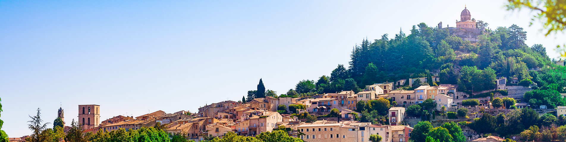
The Saint-Maxime Chapel
Perched at the top of the city and dating from 1650, it offers today a pleasant goal of Promenade. The painted decoration dates from the 18th century.
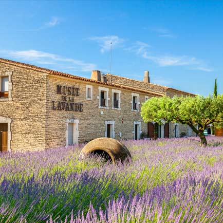
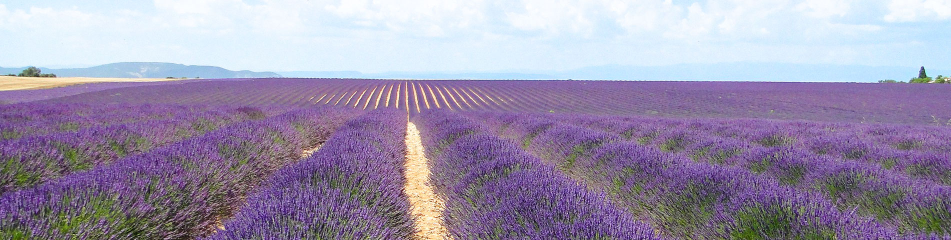
Valensole The plateau
Vast sloping plane from east to west, delimited by the valley of the Bléone, to the west by that of the Durance, to the south by the Verdon and to the east by the Prealps of Digne, the plateau offers a superb view. Formerly dedicated to the cultivation of lavender, the agriculture of the plateau is now divided between lavandins and cereals.
The village
The village of Valensole is located in the heart of the plateau and takes its name from Latin and means “the valley of the sun”.
Over the years, Valensole has kept the typical character and charm of the villages of Hautes-Provence and is increasingly appreciated for its fresh air. All this makes its visit indispensable to any tourist visiting the region.
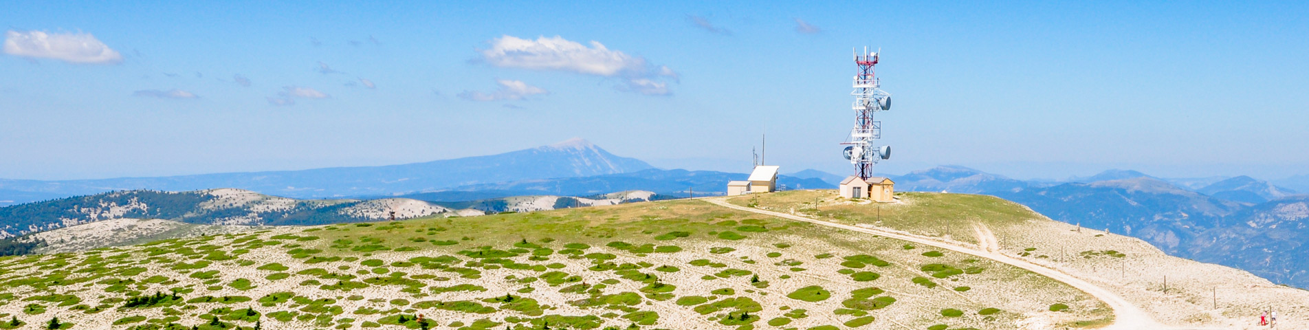
The mountain of Lure
A natural border for Provence
The mountain of Lure extends from Sisteron to the pass of Negron, and culminates at 1826 meters. It links the mountains of Albion and the Ventoux and plays the role of natural border for Provence.
Two contrasting sides
The chain results from a great tectonic movement. The whole southern flank of the mountain is a very thick mass of limestone dating from the Lower Cretaceous. On the ubac, outcrops of softer rocks explain the longitudinal depression between the main ridge and the parallel slopes that dominate the Jabron. This difference can be seen in the distribution of springs: frequent on the ubac, they are rare on the adret.
Heaths and aromatic lawns
At the exit of Saint-Etienne, the road first crosses old communal lands, worn by centuries of grazing. The most obvious plants are mostly thorny and aromatic “herd rejects” that are not eaten by the animals.
The white oak floor
Around 800 meters, the road enters the woods of Provencal “white oaks”. They are the most dominant hardwoods of the high-Provençal hilly stage. It is usually found in a crowned state due to frequent cutting. This exploitation, which takes place every 20 to 25 years, weakens the wooded environment and alters the soil. Undergrowth grazing, often combined with winter burning, further accelerates this degradation.
The beech floor
Around 1200 meters, the forest landscape changes radically with the appearance of the beech which, in the Mediterranean region, is an altitude species.
The beech forest of Lure, usually treated as a coppice, is much wetter than that of the Ventoux.
Scots pine woods
Going up the south face, we cross several times the pine woods, exploited by the paper mill or the wood processing industry. It is around 1400 or 1500 meters that this forest environment is the most original.
The beech-fir forest
This type of forest occupies most of the ubac. The Lure fir is a tree often stunted, moreover affected in recent years by drought. The flora does not differ appreciably from that of the beech forest, but it is generally more exuberant, especially in the gaps. One can discover there a remarkable vegetal ensemble.
The ridges of Lure
Around 1600 meters, near the refuge of Lure, the forest suddenly gives way to moors and summit grasslands. This open environment, with a very alpine look despite the low altitude, is the result of successive deforestation and grazing. On a mistral day, the view is exceptional.
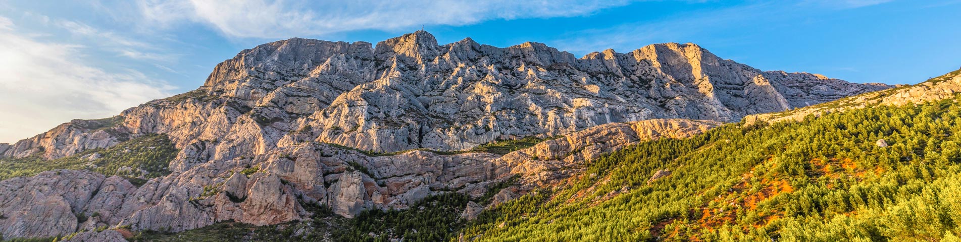
The Sainte Victoire mountain
The Sainte-Victoire massif extends over 18 kilometers
Massif which extends between the departments of Bouches-du-Rhône and Var for 5 kilometers wide.
Its summit is the peak of the Flies. It is one of the highest peaks in the Bouches-du-Rhône department, after the peak of Bertagne which reaches an altitude of 1,042 meters and is located on the Sainte-Baume massif.
6 525 ha du massif de la Sainte Victoire ont été classés depuis 1983.
Its east-west orientation leads to a great difference in sunlight between the north and south faces, and therefore to a difference in vegetation. Thus, we find Mediterranean vegetation on the southern slopes and alpine vegetation on the northern slopes.
The site of the Sainte-Victoire mountain taken as a whole has an exceptional flora of 900 flowering plants, that is 20% of the French flora.
Among the fauna, we can note many insects, 27 species of mammals including 9 bats, wild boars, hares … and 126 species of birds including 78 nesters.